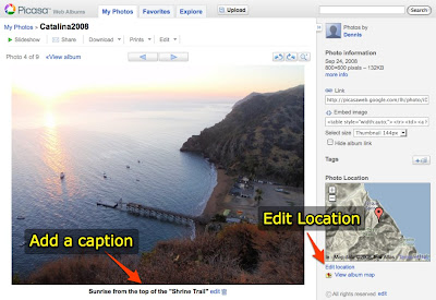
First, upload your pictures to a new Picasa Web Album. Add captions and then click Edit Location. (Click images to see a larger view.)

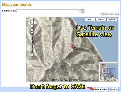
Drag the placemark to where the picture was taken and click SAVE.

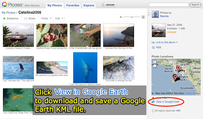
Repeat this process for each picture in your album. When you're all done, click "View in Google Earth. This will download a Google Earth KML file.

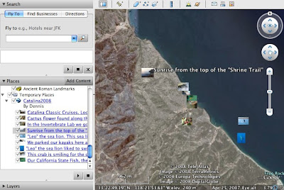
When the KML file opens in Google Earth, your pictures appear as placemarks along with your captions.

Clicking the the placemark opens an information bubble with a larger version of your picture and your caption.
Something like this would be a great way to follow up a class field trip or outdoor education experience. The example above was created with pictures from our 7th grade trip to Catalina Island. You could also share your own personal vacation photos with your class and add historical and geographic information relevant to your curriculum.


No comments:
Post a Comment