Showing posts with label project. Show all posts

Tuesday, September 08, 2009

Summer Reflections


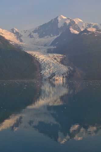
Many of you start a new school year today. In just a moment students will be arriving, anxiously waiting for the pearls of wisdom you choose to bestow upon them. Like me, many of you are probably wondering how summer went by so fast. It seems so close, yet as you frantically put those finishing touches on your classroom, it also seems infinitely far away. It wasn't that long ago, I think it was July, that I was in Alaska exploring Denali National Park and cruising the Inside Passage. When I get stressed about everything on my "to-do" list it helps to go back and re-live that adventure. It puts me back in my "happy place".

Because I consider myself a bit of a techie, I used the trip as an opportunity to dig in and really get familiar with Google Maps. Below is my Alaska Adventure.


View Alaska Adventure in a larger map

Creating a Google Map is a wonderful way to combine stories, pictures, and video from your vacation. I was able to arrange events in order, map my travel route, and place pictures and videos in their proper place on the map. It's like an interactive travelogue. And sharing my travel story is as simple as copying and pasting a link into an e-mail (or blogpost).

When editing a "story" events can be rearranged by simply dragging them up and down the list on the right side of your screen. Lines can be added to show travel routes. One feature I really liked was Google Maps ability to make lines follow known roads or highways. (I don't even think you can do this in Google Earth.)


I had no problem adding photos I had posted to my Flickr account. In the "rich text" editor you just click on image button and paste the URL.


Google Maps will also accept some embed code. Using the "Edit HTML" feature, I was able to copy and paste code to embed video clips I posted to YouTube. Since Google owns YouTube it makes sense that this would work. I did not have any luck trying to embed something from Voicethread however. It may take some experimenting to see what it will and will not accept.


As you can imagine there are lots of possibilities for using Google Maps in the classroom. Maps are a great way for students to grasp large amounts of data in a way that isn't overwhelming. Here's one that shows recent earthquakes around the world (earthquakes.tafoni.net). Do you think your students could use this information to locate the boundaries of tectonic plates? If your class is looking at current events, the LA Times has one with updated info about the Station Fire.

You can also get students involved in creating Google Maps. In an earlier post I showed a "Breakfast Around the World" map created with data collected from our 3rd graders. Colette Cassinelli created a project she uses with her students called "Postcard Geography". I can see our 5th grade teachers doing something similar for combining information from students' state reports. (Colette also has some great Google Map links on her wiki.)

One hurdle you need jump when using maps with students is that Google Maps is not part of Google Apps for Education. So in order for students to edit a map or create their own, they need to register with Google and create their own Google account, or use one created by their teacher. Otherwise the teacher will have to take work submitted by students and post it to Google themselves. (That's what I've done.) Hopefully this is something Google will add to Apps for Ed in the future.

Enjoy playing with Google Maps and if the new school year gets a little overwhelming, take a time out, think back to summer and map your summer memories. I think I 'm going back and look at some Alaska pictures right now.

Thursday, April 02, 2009

It's All About the Network

Have you seen those Verizon commercials that have hundreds of support people standing behind their wireless phone user? The idea is to let you know that you're not alone, that you've got people behind you to keep you connected. Their slogan - It's all about the network. That's how I felt about MY network this week.

On Tuesday morning I worked with one of our third grade classes. They had just read the book "George Washington's Breakfast" by Jean Fritz. Our idea was to create a little form, asking the world what they ate for breakfast. I opened up a new form in Google Docs and had the kids help write the survey description and questions. Then I posted a link to the form on Twitter and Plurk asking you to show them the power of our network.

The results were practically instantaneous. Within 15 minutes we had a dozen responses. By that evening there were over a hundred. When I checked the next morning there were almost 400! Most were from the US, but we also had responses from Australia, New Zealand, Japan, Scotland, Italy, China, Singapore, Korea, and Brazil!

I thought it would be fun to add the responses to a Google Map, so I started copying and pasting what people ate into placemarks. I had to stop after the first 200. I just couldn't keep up with the responses.


View Larger Map

We're still working on what we're going to do with all the data, but if you'd like to share our project with your students, here is a link to our spreadsheet. (As I write this, we're up to 469 responses.)

I'd like to thank all those who contributed to the survey and passed it on to others. The kids had a blast watching the results come in. We were all amazed by the huge response. Our network ROCKS!

Monday, March 17, 2008

Every Place Has a Story

Imagine this...
  • You're on visiting a historic Civil War battlefield. You're carrying a GPS enabled PDA with you. As you walk into a particular area your PDA starts playing a recorded story of what happened on that spot. Old photos appear on the screen showing what you might have seen had you been standing there 145 years ago. As you leave that area, the audio fades out. You continue exploring and as you do different voices, sounds, and images appear specific to those locations. It's as if those places are reaching through history to tell you their story.
  • You're walking through a park near your home with that same PDA. Suddenly a voice prompts you to stop and look around. It points out specific geological or natural features visible from where you are standing.
  • You're strolling through the neighborhood near your school. As you walk through certain areas you hear poetry, music, or stories written by your students who were inspired by those locations.
You've just experienced place-based learning. This weekend I had a chance to attend a workshop at KQED in San Francisco. Leslie Rule of KQED led the discussion as we shared ideas and brainstormed ways that place and space can be used to add an extra dimension to learning.

Many of us have seen how tools like Google Maps and Google Earth can connect us virtually with just about any place on the planet. Google Lit Trips takes events from books and links them to places. Imagine following the journey of the Joad family from Steinbeck's Grapes of Wrath, or the story of gold seekers traveling from Boston to California in Sid Fleishman's The Great Horn Spoon.

Google Maps is valuable tool for organizing data and information by location. During the California wildfires last fall KPBS used Google Maps to share place-specific information with the public and alert communities of evacuation areas and road closures.

Using Google Street-View you can virtually stand in Dealy Plaza and survey the scene where JFK was shot, look up at the 6th story window where Oswald was perched waiting for the motorcade to pass by, and click down the street to the spot where the fatal shot struck the President.

While these types of place-based learning can all be done from the comfort of your own computer screen, the real power of place-based learning happens when you step outside the classroom and into the real world. You experience the content while standing in the actual spot - seeing, hearing, smelling, and feeling it for yourself. This is where things really start to get fun.

Using GPS enabled PDA's and Mediascape software Leslie showed us how to actually create a simple version of the imagined projects described above. We pulled in a picture from Google Earth of the area just outside KQED and programmed in the longitude and latitude coordinates. Then we created zones on certain areas of the map and imported pre-recorded audio that would play when the device entered those zones. Once the "mediascape" was created it was downloaded to the PDA and we ran outside to test it out.

We turned on the PDA's, waited for the GPS to acquire our position, and opened our downloaded file. The map and zones appeared on the screen we started walking. Upon entering a zone an audio clip started to play. As we stepped out of that zone the clip stopped. Errors in the GPS positioning meant that different PDA's were triggered in different spots, but for the most part, the experiment worked!

Admittedly, the technology we used was a little glitchy and it may be a while before this type of project becomes practical. The software we used only works with Windows and Windows Mobile enabled devices. Since not many PDA's are equipped with GPS capability, we had to use a separate bluetooth GPS unit to feed our position to the PDA's. It worked for some and not for others, but everyone did get a vision of how powerful this type of learning could be.

Even if you don't have all the equipment you need right now, you can still start thinking about and creating place-based content with technology you already possess. For example, you or your students could record content and upload it to your web site. That information could be downloaded to an iPod or mp3 player. Your students could use handheld GPS units or even paper maps to indicate where to play certain tracks. Then, in the future if you do get PDA's , that recorded information would be ready-made and easily moved to a GPS enabled hand-held device.

If you have no equipment at all, you can still create an educational "treasure hunt" called an EdTrek. KQED's Quest web site has an example and instructions for creating your own.

However you choose to implement it, the important thing to remember about place-based learning is that every place has a story. It could be geological, historical, personal, or inspirational. For your students it could be a specific place that works like a trigger to get them writing.
  • Tell about something that happened here.
  • How does this place make you feel?
  • Use your words to describe the sights, sounds, textures, and smells.
For those making the learning journey through those places it will give them a new perspective as they experience that place through the words of another.

Place-Based Learning Resources:
Create-A-Scape - Software to create a mediascape.
KQED Sample Quest
Lesson Plan for Creating an Ed-Trek Activity
"No Student Left Indoors" by Jane Kirkland
Google Lit Trips

NOTE: I would not have been able to attend this workshop without a generous invitation from Janet English of KOCE. Thanks Janet for the invite and for all you do to support teachers and technology in Orange County.